Place Your Ancestors:
Your Guide to Using Atlases, Maps & Gazetteers R |
 |
Research is much more effective if you aren't plucking people and events out of thin air. Just as history is important to a genealogist, so is geography. Maps show us jurisdictions and boundaries -- and for that we often want to see historical maps. Virginia looked a lot different in 1791 than in did in 1891 or 1991. If we possibly can, we want a map from the time period of the research. Maps show us distances and proximate places. We know how far people moved and how close they were to other family members. Maps show us physical features... mountains, valleys, rivers.. as well as cultural points of interest, such as churches and cemeteries. Maps can place military and other historical event and show us migration trails that our ancestors traveled. |
Start with a book that teach about using maps for genealogical research -- to buy or read at a library.
Walking With Your Ancestors: A Genealogists Guide to Using Maps and Geography. Family Tree Books, 2005 (find in a library)
Atlases
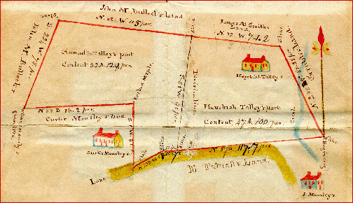
Atlases are a series of maps compiled in a book, often annotated to to show specific information, e.g., land owners, county boundary formation or military events.
County Atlases
These are invaluable, especially so because they contain maps of townships, villages and cities as well as the county.
Images from the 1895 U.S. Atlas (all counties in the U.S.) have been scanned and are available online. (Scroll down to select the state you want; then choose county)
Here are a few projects to digitize historical county atlases and provide them online; to see if there is one for the jurisdiction use a Google search with words historical county atlases digital. Here are some examples:
- Michigan County Histories and Atlases provides early Atlases for each county in Michigan. You can search for individuals or browse the atlases. Locate an atlas for a specific county by using the "bibliographic" search and specifying the county name in the title and the word atlas in the title.
- The Canadian County Atlas Digital Project. Use the search box to find maps or surnames.
- Iowa Counties Historical Atlases The only way I could find to print the image was to right click on it, then save it to your computer and print from there. But perhaps I overlooked an easier way.
Boundaries & Jurisdictions
- When working with U.S. records you will want to use Dollarhide's Map Guide to the U.S. Federal Censuses, which shows the boundary changes for each county. (Find in a Library)
- Newberry Library published:
- Historical Atlas and Chronology of County Boundaries, 1788-1980. (find in a library) A five volume set unless combined with the title below; if so, an 18 vol. set. Too expensive to purchase for home use, you will more commonly find these in large libraries.
- v. 1. Delaware, Maryland, New Jersey, Pennsylvania
v. 2. Illinois, Indiana, Ohio
v. 3. Michigan, Wisconsin
v. 4. Iowa, Missouri
v. 5. Minnesota, North Dakota, South Dakota
- Hathi Trust offers the ability to search these volumes (but not view)
- Atlas of Historical County Boundaries (find in a library) Some libraries catalog this by state; others include it with the title above.
- It adds these states: Mississippi, New York, New Hampshire, Vermont, Connecticut, Maine, Massachusetts, Rhode Island, the District of Columbia, Kentucky, Alabama, Florida, South Carolina, North Carolina
- BOTH SETS NOW ONLINE AND FREE at Atlas of Historical County Boundaries (courtesy of the Newberry Library in Chicago).
- You will have to take some time playing with it to see what is available.
- When viewing an interactive map, notice the HELP button, upper right; you may end up needing to use it.
- The Goldbug sells Animap 3.02 County Boundary Historical Atlas, a software program that locates places and shows county boundary changes over the years. Note the they also sell maps on their site.
- And note! There is also an
Migrations
Maps
Ideally we will find a state map showing counties and a county map that shows towns, villages and cities. This allows us to more concretely place our ancestors and get an idea of distances between various locations.
State maps
- Handybook for Genealogists (10th or 11th edition) (Find in a Library) contains maps as well as addresses, links and basic research information for every U.S. state and some foreign jurisdictions.
- Ancestry's Redbook (you'll want the 3rd edition) (Find in a Library). contains maps as well as addresses, links and basic research information for every U.S. state and some foreign jurisdictions.
- Ancestry's Redbook is now available online! Free! At this link, scroll down to select a state. Once you have selected a state,scroll down the list on the right hand side and at the very bottom pick map. This will show you the map for the state, including proximate counties of surrounding states. You can do a "save as" to put the image on your computer, or print it out for use in your research. You will notice a link midway down the list for [statename] maps. This is a page that describes other maps available for this state.
- Use the colorful state maps at Digital Topo-Maps.com. I often link to this map on my state websites. (I mean to always link to one, but I'm not yet up to date.)
County Maps
County maps hat show us townships (towns), villages and cities, as well as perhaps Perhaps also cemeteries and other important places, are just as important, but can be more difficult to find.
- There is a book that contains township maps for the whole United States. It is Andriot. Township Atlas of the United States. Libraries will often hold two editions, one from 1979 and one 1981. You may need to check both as some maps differ in how they are presented, especially those for urban areas. Find in a Library 1991 and 1977
- Sometimes you can find township maps on the Wikipedia page for a given county. Here is an example for Erie County, New York. (scroll down to the townships section to see the map)
- Another example can be found for Lycoming Co. Pennsylvania (again scroll down to the townships section ).
- Sometimes a U.S. Genweb county site will have a map of that county that shows townships.
- Arphax is creating township maps, with names of first purchasers of lands in a given county. They will accept requests for specific counties. They also offer a subscription service that allows you to see (but not print ) these maps. They do not yet have all counties in the U.S. completed, but continue to publish as they complete a county.
Township, City or Village Maps
Maps of a specific township, village or city can also be useful. They are more likely to show detailed information, such as land ownership, locations of cemeteries, churches and other important places. They also are more likely to show place names that might not be found in maps of larger jurisdictions, which are more likely to sacrifice details. You are most likely to find a township map in an atlas for the county, but you might also send a request to the local library or the local government office for a reference to a good map of the township or city.
Topographic maps
Topographic maps show natural (and sometimes cultural) features that are often absent from the types of maps we are used to using. For more information, see this Wikipedia article on topographic maps.
- For current U.S. mapping, see these two websites maintained by the U.S. Geological Survey
- Historical topograpic maps
Other maps
- Panoramic, or " bird's-eye view" maps were popular in the late 19th, early 20th century. An online collection of panoramic maps is available at the American Memory Project. (You have to read the instructions to zoom in enough to get a good image)
- Sanborn Maps exist for about 12,000 cities and towns. They were created starting in 1867 for fires insurance underwriters as a means of assessing fire risks; towards that end, they show information about the buildings in a given area. Because building type was shown by color coding (yellow for frame, blue for stone, red for brick...) They are online, but you must be affiliated with an organization that subscribes. (The University of Michigan Library does !)
- The online version is difficult to navigate and the maps themselves require study to understand. You must use a key (color key) to make sense of the drawings. They do not contain names, only addresses... but you can often get that from a city directory, census or some other source. The Library of Congress offers a guide to using Sanborn maps (and an inventory of what they own).
Map Collections online
There are some map collections available online, but I am rarely able to bring up a good, viewable copy to work with. Maybe it's me. I use them to find out what maps exist and if one looks good, I can often order a copy. Or see if I can find a copy at the University of Michigan Library. Map Library . (See their Genealogy Research Guide for Maps, Atlases and Gazetteers)
- The Perry Castaneda Library Map Collection Online contains digital copies of maps from all over the world, including many historical maps. U.S. Historical maps are arranged by city. This site also contains a list of links to other historical maps on the web.
- The David Rumsey Historical Map Collection contains a great number of historical maps. I found it difficult to navigate until I discovered that you must first select a browser. Once you do that you can more easily locate maps of a specific area. I also found it difficult to view maps until I realized that when magnifying a map you must click on the portion you wish to see magnified. Once an image is larger, there is no way to navigate from one portion to the other. On the whole I found it hard to use this map collection.
- University of Alabama Historical Map Archives -- again, I could not get a map image large enough and clear enough to be useful, but I can find out about maps that exist and see if I can find them in the map library or purchase them.
- The U.S. GenWeb Archives now hosts a U.S. Digital Map Library with some digital maps contributed by users. It is not comprehensive, but growing and worth checking.
Gazetteers
A gazetteer is a listing of place names... it helps you locate a place if you only know the name, but have no idea where it is. A gazetteer is a handy reference book to have on hand, but there are also gazetteers online.
Often, however, you will want a gazetteer that was published long ago because it will, include names of places that are no longer used. Some gazetteers have phonetic variations in the spelling of names; if not, you will need to try under a variety of spellings, as the one you have in hand may not be correct. A few historical gazetteers are available online at Google Books -- there may now be more than listed here.
Vendors
More Links
Back to Bobbie's Genealogy Classrom
This page last updated
April 15, 2012